GOD is great! As a kid in Jinja (1984 to 1995), I loved going near Lake Victoria (to gaze into the unknown and let my problems go or fly away like the legion demons which JESUS cast out of two men in Gadarenes), Source of the Nile where the water spun in an unusual way and berries tasted transcendental plus spraying plastic-hosepipe-water on ourselves with friends for fun even across Owen Falls Dam in N(kokon)jeru (since we had no expensive waterguns); it thrills and relaxes. Overhead bathroom showers do the same thing. H2O is life, makes up 70 percent of our bodies and planet: JESUS was baptised by his cousin John with water and turned it into wine, not kombucha. Sometimes when I looked East while on top of Arua Hill (peaceful place I go to when I want to unwind, heal or reset my aura instead of feeling low - Depression is a choice), I would helplessly wish there was a heart-soothing, mind-pacifying, pain-drowning-lake nearby (since Albert and Nyoro Crater or Rokoze which I call Lake Maracha are too far) instead of Barifa Forest. The other wish was for River Nile to be visible via binoculars view almost like Mt. Oce in Moyo. However, finally motivating myself to check out (chase and explore) Yia Chalu (aka Abairo Falls) before the Apocalypse, emulating Sir Samuel Baker, on Thursday 20th February 2025 somehow brought my wish to life. My eager heart was pounding steadily with wonder. Abairo Falls is a walkable distance from Arua City even if you take some exhausting time to get there. All that matters is knowing the route. You can as well hire a bodaboda motorcyclist to ferry you there in at least 15 minutes!
 |
| Abairo Falls in Oluko (East of Arua City)... |
Below are directions to Abairo Falls (owned by John Acile) on River Asa which flows into Acha: From Arua Hill Roundabout, turn right and follow Weatherhead Park Lane. Cut right onto Oluko Road until the football field near Alua Primary School (Education is the Key to Success), then cut right again plus follow the right curve (instead of left split) near Malingumu Events Amsterdam (that promotes boxing in Arua) for 2 kilometres until you cross River Asa bridge. Shortly after it, the road curves right towards Ambeko, but move straight on your left. This is the trickiest moment of the journey; if you get it right, you will find yourself near Oluko Falls (a series of waterfalls). On this lefthand route which I call Waterfalls Road, you will find homes, a camping site, forests, grasslands, gardens, Shine office with roofed car-park and finally Arise Center on your left. As you approach your destination, you will see breathtaking undulating hills and valleys on your rightside; it's quite unbelievable considering the flat near-plateau appearance of Arua close to the city. There are scattered people on the way, so you won't feel completely lonely as you slope: You have reached Oluko Falls (though some locals deny that name; I think it's a series) which starts with Oloporoporo Falls (bought by an American humanitarian from Acile's uncle) on the left of a uniquely-designed-and-painted shop (with a green ironsheet roof just like the bigger houses behind it on the same compound). Abairo Falls near (then 57-year-old) John Acile's home next to a metallic roadblock is farther down at the bottom end of Waterfalls Road. Acile's place is where your vehicle stops (and you may have to pay some money - around 2K UGX - for his family to watch it for you; Gate Entry fee documented with Abairo Waterfalls Friends Association receipt starts at 3K for locals, 5K for Indians and 10K for Bazungu), but you can hear waterfalls roaring from here though won't see Abairo until you slope farther past the foodhouse, sheds and latrine. It's a very good outdoor exercise adventure even if you start panting for breath. You can even sit on a bench or chair and watch the riverwater just before it falls down the gorge, technically the reverse Top of Abairo Falls. There is floating safety-equipment for learners or young swimmers eg black inflated-tyre-tubes. Between both waterfalls are smaller ones (one of which I named Ac[h]ile who showed it to me) or rapids (whitewater) and the land across the river in this stretch was bought by BN Group (an Anglican organisation) who plan to build a hospital plus Bible Study University.
Another TikTok-uploadable route is from Muni through a panya at Our Lady of Rosary Ambeko Chapel (Eucharistic Centre in Oluko Parish of Arua Diocese) or to Ambeko-Oluko Bypass Junction, then turn right towards Ambeko Primary School with borehole on the side and follow the road after the school until you turn right. You can also follow the left-right-left-right winding road only until you reach a sharp corner and turn right. If you go farther, you will reach the first route above and see the Asa Bridge; Waterfalls Road starts when you cut right. Before my mother departed in Twenty22, I had asked some people in a garden along the motorway connecting Oluko Road to Muni and Ewuata where Oluko Falls was, but they didn't know and grey clouds were hovering above warning of rain, so I went back home. However, I discovered that about 300 metres after the triple-culvert River Asa Bridge is another diversion on the eastside that links you to the above mentioned Ambeko-Oluko Bypass at a Y-corner; you basically have three (to four or more) routes.
I have decided to follow JESUS!
Magubaku [Do not laugh at people] (Try yours)!
The name Abairo is inspired by the concept that "yi wala ndeni angu 'di ma alea; yi badaka" [most voluminous water is in this area; water is a lot]!
 |
| Arise Center in Oluko, directly west of Abairo Falls... |
 |
| Sunrise in Oluko (Arua); Abairo is down the hill... |
The Almighty GOD (No one compares to HIM) made Miriadua Falls in Maracha, the World's Most Powerful Waterfall at Murchison (Kabalega) Falls in Bunyoro, Rift Valley escarpments and mountains in Western Uganda plus Aliw Falls in the Philippines, but in Oluko, it's like HE mashed them up together as mini-photocopies or minimalist replications; so amazing! The weather is even the same as Western UG.
 |
| Oloporoporo Falls (owned by Mike Elkins)... |
Oloporoporo Falls also called Upper Abairo Falls (Wonder if it's the Whaa Falls I used to read about one kilometre from Abairo, but definitely Mundu ma Yi [Whiteman's water]) is approximately 7 metres high with flatter block-shaped rocks reminiscent of Miriadua; I saw a manya [monitor lizard] bigger plus longer than my forearm below the elbow jump into the vegetation growing on the left of the rocks. Olokoto poroporo [Many red-orange-headed geckos] are the reason for the name of the falls. Pond-swimming (What we called dubi in Naguru) is difficult there because of many rocks at the bottom of the shallow pool. However, changes are being made with removal of rocks. Germans visit Oloporoporo a lot. On my 3rd visit to Oloporoporo Falls (Sunday 16th March Twenty25), I snapshot some photos plus captured a short video of the multi-step waterfall, refreshing like two doughnuts and 320 millilitres of Exotic Tamarind-flavoured carbonated soft drink from Riham. A distance from this area, Mike Elkins built his beautiful home. There is also a camping site, Arise Center (Hall) and cottages as though it's the Rwenzori Mountains in Kasese and Toro Kingdom; just splendid, priceless scenic views like in a Uganda Wildlife Authority (UWA) national game park! YESU le ma aga [JESUS loves me beyond]. Mike plus his wife Megan bless orphans and disabled people in Vurra, Madi and Terego plus South Sudan with medicine, tuition, food and accommodation (3-roomed iron-roof houses for those with families and grass-thatched huts for old beneficiaries). There is a trail near the river linking Oloporoporo to Abairo and its tree canopy reminds me of Nabinonya Beach in Kisubi (Buganda). Encouraged by Government and National Forestry Authority (NFA), Acile wants to plant mario [mahogany] trees at the riverbank. There are also pines, banyan trees, a'ba (which is not planted and grows in rocky places), idioko and other shrub trees in the vicinity though many were cut for brick burning (Apparently, plastic bottles can be used as an alternative for both burning fuel and creating longlasting construction bricks with soil inside). Some people catch fish called njorofi which resemble ngenjia [silverfish]. Only GOD could have assembled these Oluko rocks together, not Nephilim giants; HIS name be praised forever! |
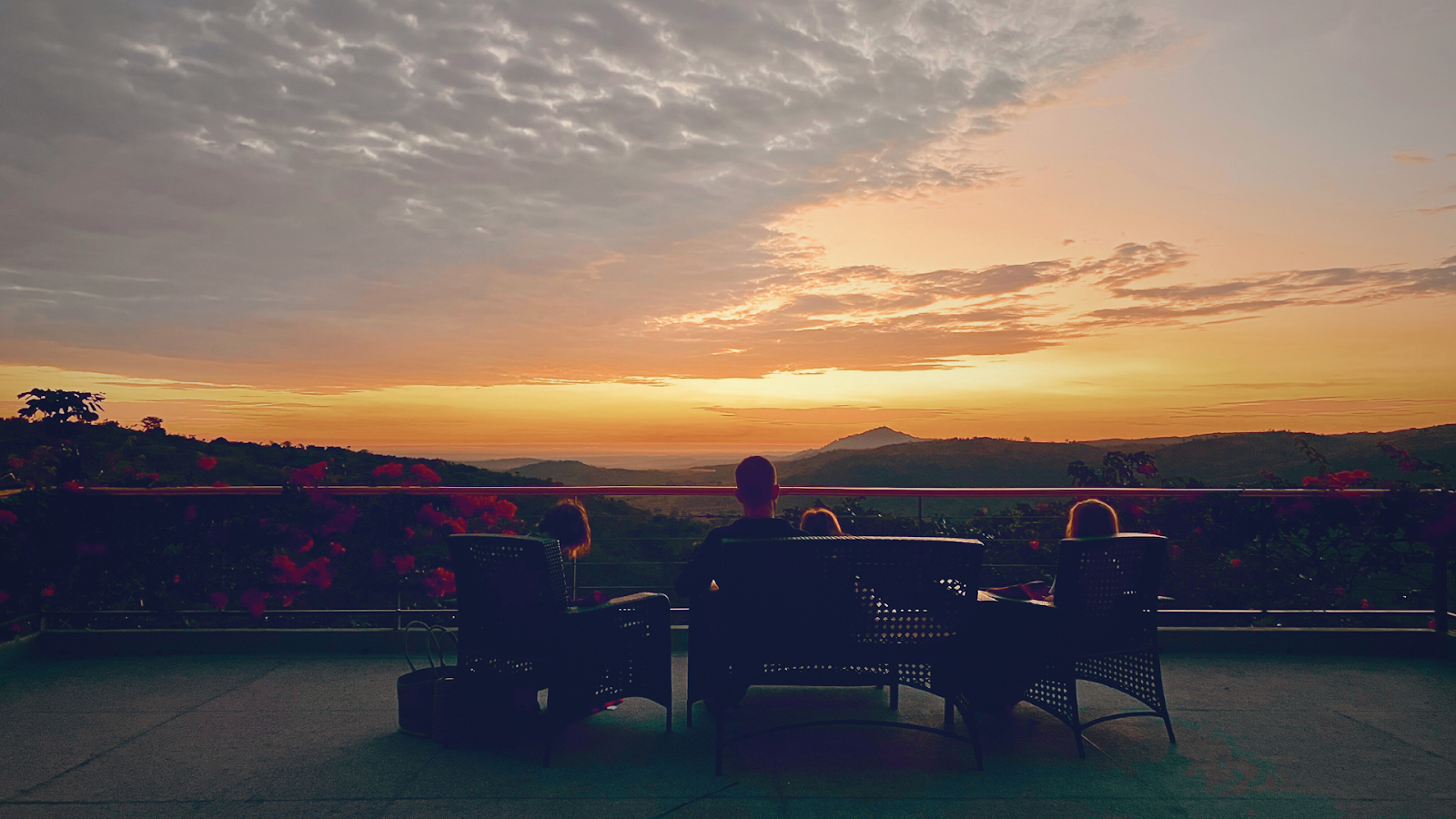
| Visitors enjoying Abairo Falls (Ayivu)... |
Downstream, Abairo Falls which is about 16 metres high (according to Acile though I calculated close to only 10 from waterdrop onto gorge rocks to pool surface) has a bigger, more swimmable rock-pool with sandy bottom even if rocks with various shapes surround it. The cement-steps leading you safely to the base have about five zigzag bends. When you reach down, you will appreciate the majesty of the giant rock on the other side towering above you higher than a double-decker bus, six-storeyed building or big-wheeled Caterpillar truck used for carrying rocks in a quarry, but not higher than Sipi Falls in Kapchorwa nor bigger than Zum(w)a Rock in Niger State near Madalla and north of Abuja (Nigeria): Ancient Nigerian ancestors came to the Highest Monolith on Earth in the middle of their country to catch "ezu" [guineafowls] hence the name of the rock; I guess they would love this Lugbara heritage site too because it has what they were looking for. Abairo is open all-week, but most people visit on Sundays; Somalis hold parties on Saturdays. Fun-lovers and stress-shakers come for tranquil picnics, environmental vibe, birthday parties, tours (In 2024, around five schools came), meditation, photoshooting, relaxation, laid-back enjoyment, birdwatching, fresh air, romantic dates, change of atmosphere from noisy car movements and restless urban activity, etc. The preferred time is after 3pm; watching the sun set at Abairo can be a wonderful experience! The mornings are also not bad as you enjoy London Bread daddies from Gulu or any other edibles you fancy. Arise Center can provide food for you if you alert them early (The spot is visible in the West at the top of the hill). The Abairo area is quite cold in the morning like Kabale (Kigezi). Do not get close to the steep cliff! Acile discovered the falls around 2006, but started digging up the side in 2007; ten years later, the place was used as a tourist attraction. A Whiteman saw the horsetail, punchbowl-esque waterfalls while flying over Arua and bought land near Abairo Falls from Acile and his family. Security is not yet enough for sleeping at the venue, but if people come with their own lights and watchers, they may stay for the night. The river flows all year long, though during the rainy seasons, the water gushes farther than expected and covers the swimming area. City Government plans to build a reservoir and generate hydro-power. Acile has eight children (three boys including Jacob Yuma and five girls including Delila Agazu). Animals you might spot here are: eto [Translated from Lugbara: rabbits], ndiria [small bush animals resembling goats], etc. Birds include kolikolia [black and white birds], ope [wild guineafowls with dark feathers], a'bulo (feed on ori ifi [seeds], anya [millet], etc and are very many), nderaperio (with yellow beaks), small blue and brown birds, yudu (all-red birds), vultures which only eat meat, okoloa (which build big houses and suck tree sap), ohelu [crested cranes] fly in large numbers from Ajai Game Reserve in Madiland to Congo during August (the 8th month) when groundnuts are gathered (They do not like the dry season), kapio (many in Arivu - down South), etc. Snakes are rare. Acile wants an itinerary calendar scheduled for visits. River Asa comes from Ragem Catholic Church, grows bigger in Onzivu, Muni, Bangiriyo, Ambeko and then reaches Wandi - similar in name to the trading centre in Terego because people who settled near the waterfalls came from Terego. Lugbara would gather to dig and mushrooms cooked in ala [groundnut paste] was their payment: You dip the mushroom in soup and give to another person. Someone dipped and swallowed causing a conflict; he's the one who left Terego and settled in Oyufi Village, Wandi Ward. MUNGU awa drileba ndundu [GOD has distributed blessings differently]. Acile was a District Engineer at Arua District Local Government, then got sent to Soroti where they bathed for 200 Ugandan Shillings at a waterplace that reminded him of his own at home. When he returned, he worked on it. Acile wishes musicians film their videos at his site. Candia the Orphan (Lugbara film) actually has footage from Abairo Falls.
Water cleanses, quenches thirst and takes bitterness away! H2O stands for Double Happiness & Oxygen...
 |
| African, refreshing, unchained, amazing... |
[Ignorance is not bliss]! I cannot believe I lived in Arua since Y2K, read about Abairo Falls and even moved around Oluko and Ambeko many times (on foot plus bike), but never stepped foot at the iconic Oluko Falls for over two decades simply because I imagined it was too small to tickle my fancy (I was dead wrong: It's good enough); the final discovery was awe-inspiring! Whenever life pushes you down and you fall, get back up! Sometimes, the Abairo rock-pool is so clear on the edge that you can see the riverbed. I wish my majestically tall, comprehensive Senior 4 Geography Teacher (Miss Kabasinguzi) at SMACK had taught me about Abairo, in addition to Rhinelands, Tennessee Valley, New York, etc. On Friday morning, I hardened my heart (No sleep until I finished posting before sunrise, felt strong like Samson the Nazirite of GOD) and created a Wikipedia article for Abairo Falls; didn't even find Miriadua (but created it too on Sunday morning) nor any other from West Nile. Arua is indeed sweet and excellent; no matter the size, small or medium! Leave your burdens and worries behind!
"Kati ndaba" [Luganda for: Now I see]!
My Third Trip to Abairo Falls
GOD is great! Where I come from in Ojapi (Maracha East): Na ca ra [Translated from Lugbara: Three is enough]! If you want to enjoy something good, then do it at least thrice! On Sunday 29th June 2025, I decided to walk to Abairo Falls for the third time in less than half a year; met campus fellow Petersen and diligent constructor Moses along the way after prayers. At the junction to Oloporoporo Falls, I saw Nema (Delila's daughter, the resemblance did not lie) as if she was waiting for me or maybe had come to the closed shop. I asked her where the office mentioned on the black signpost was and she replied: Arise Center. When I reached Shine, I cut left to head towards Mike's home; Nema called me back and warned that there was a big "European" dog there that might chase me from the unfenced compound. I ran back to her and asked the AC gateman for contacts so that I can ask for permission to see the Upper Falls; he told me to visit during weekdays. After Arise Center, I helped Samson carry his yellow 10 litre jerrycan of water up to their home. I also met Blessing, Manuela, Delila and Ndugu (John's son; he resembled Delila) who came a short time later. John requested Nema to buy donuts, tea and sugar for me plus another person to prepare hot water in a flask. Meanwhile, we walked to the waterfalls; John started cleaning the whole place, collecting bottles and chicken offals rubbish left behind by about 29 Arua One FM staff who had been there the previous day. John said he danced plus took photos with their boss lady from Kampala; she thanked him for taking good care of the home. Three tubes were down at the main arena.
The Arua Town Clerk plus a colleague and their 4X4 pickup driver were the first visitors I spotted; they found me sitted near the topmost point of the waterfalls. I walked them to the steps so that they could get the main POV, then returned to my observation area at the wooden benches.
After drinking a cup of Ngoma (New Tangawizi Tea) from Oboja Road in Jinja (My beloved hometown) and eating one of three cube donuts (Gave away the remainder), I helped the older ladies and younger boys carry a total of 11 rocks (Most times had two at a time plus three once) on my right shoulder up the slope to the beginning of the groundnut garden. My beloved 20 year old maroon, blue, white kitenge shirt got torn infront and at the back yet I had just mended the lower points the preceding day. I always worried that I had overworn that shirt and maybe GOD helped me get over it in the right place: A tourist attraction with international potential.
I chatted with John after lunchtime and he told me many things I had never heard of like the First President of Uganda would have been a Lugbara (Engineer Roy Tiyo's father who contested with Obote), but was killed plus sang a song ("Oda ni tezu DP ru, aga Kongresi ra. Obote, mi di Lango-a le 'di ya?"); British believed the Lugbara were stronghearted and gave them tobacco and cassava plus cotton which grow for a year; Kuluva Hospital generated 5 MWs of electricity, but it was not allowed to cross the road by authorities; some Churches like the Oyet group and Catholics go to Abairo for services and sit on mats; showed me the ajinguru plant which is like a Typhoid vaccine when boiled in 20 litres of water and drank daily in the same way as water; narrated how Banyale (who first ate human liver dropped by a kite and went on killing people's kids after cow and goat liver did not taste better) came from Lango (which I didn't know) through Acholi and Alur (which I also didn't know) before settling at Mt. Wati with Ofunyaru plus giving birth to the Terego and Maracha clans as well as Ayivu (Third son) and Madi who neglected the Lugbara; Wandi Parish in Ayivu is filled with people from Terego because two brothers separated after a mushroom-dipping conflict that saw one of them move from Wandi Town in Terego through Ajia to Oluko in Ayivu; five seeds of ripe pawpaws every week treat worms (I also told him that raw pawpaws chopped into small cubes and fermented in water for about four days heal ulcers); Lugbara clans in DR Congo include: Onika (where Bakoko comes from), Bolo, Aligo, Logo among others which I already knew (to make a total of about 13); Millet porridge and tamarind plus groundnut paste give strength; etc.
About seven different motorcycles came to the reception yard: Half had three people each (Saw only one female visitor among the trios); two dudes came on one bike and took so many photos (plus asked me what the hanging buns were for and I told them they were hanged by Arua One staff); about two guys each came solo. The other female in all pink came with her male friend wearing all white and speaking Luganda in a silver Subaru hatchback with a UBJ numberplate; they first went to the pool down below before coming to sit briefly with me and three guys on the benches (The one with a black Esomart hoodie played mainly Bongo flavour music from his smartphone via a bluetooth speaker; Diamond Platinumz and others).
Some observations I made: There is a small pool on the East Side near the top of the cascade; huge 7 meter rock divides the waterflow into two pathways at the top before it drops as one again; another point of interest lies between Oloporoporo and Abairo like rapids you can hear when you reach John's homestead and only accessible via a riverbank sideroad; Abairo sound can be heard from the road directly below Arise Center cottage house; yellow railings were made by Kiboko; hill on the East gives you a bird's eye view of the falls; the riverwater is dirtier during the rainy season which starts from March though clearer when rain stops after December; the steep slope is easier to walk on when rain falls than during the dry season; etc.
The sun set, so I walked back home quite fast on Waterfalls Road (and even overtook the two dudes who had left before me) in order to find a bodaboda who I might have found after a kilometer or more. Nevertheless, Shaban had come to do research late and I told him Ndugua was the right person while I left. When I passed Shine, they both bypassed me on Shaban's bike, but I think Ndugua asked the stranger to carry me too. I hopped on, Shaban stopped to snap a picture of the new Abairo Falls signpost from Explore Uganda and Arua City, then Ndugua got off at a trading center on Oluko Road. He told me most people do not care about the falls, but Abairo impressed him. Shaban ferried me all the way home; we even picked my Youngest Sister at the Mango Road & Weatherhead Park Lane Junction. My third visit to Abairo Falls was truly enjoyable because I was in Chill Mode basking in about three-quarters of Vitamin D sunlight in Oluko. The golden sunlight in the afternoon - beaming from above Arise Center in the West - reminded me of the golden light I saw while in Kyebando Kisalosalo (KLA City) during the Pakwach eclipse: Transcendental rays through the leaves and under the shades. Abairo can make you renew or reset your mind, body and soul with its non-stop roaring waterflow plus refreshing air which reminds you that life should not end no matter the distractions, bends, meanders nor depressions.
Miriadua Falls (the Most Mentioned and arguably Most Popular Waterfalls in West Nile) is found on River Oluffe in Maracha about 20 minutes to half an hour by vehicle northwards from Arua City and after Okokoro plus the curvaceous Kijomoro Bend, but before Koyi. At a junction with a signpost of Kakwa Cope Centre (found 200 metres inwards), you cut right and move farther for 2 kilometres until you see Ambidro Health Centre III with about four to five houses roofed with blue ironsheets near each other on your left; cut into the road before them and move 400 metres until a gate. There are pools for swimming down ahead from the falls. Stepped there on Sunday 23rd March 2025 at the beginning of spring and was amazed by the size of the rocks as viewed from downstream and at the top; the water actually moves through about 100 metres of rock before the main fall, absolutely amazing! The rocks tilt northwards, so water flows closer to the farther end and onto the right when less, not all over the place. There is even a cave at the bottom below the topmost point as the whitewater splashes. A man from the city was fishing for small tilapia-like fish called
lopo using a hookwire on a stick while two boys scooped water with plastic containers to catch their own. Three brothers (younger two looked like twins) skilfully swam naked downstream as girls washed clothes midstream and goats grazed uphill. Before the location where water finally falls, some women dried cassava on the southern section of the river channel where water did not reach because of the dry season. When rain starts, it is impossible to find that space. Several other people especially youthful males passed by. I felt like (Riccardo) Calafiori at Molineux (Wolverhampton Wanderers stadium) in the 2025 season.
 |
| Miriadua Yi-kuru (Maracha)... |
Miriadua Falls is a great relaxing venue for parties, dates, picnics, festivals and corporate outings. After my fun-loving cousin Margaret Amaguru departed the Earth on Saturday 15th March 2025, I went to Oloporoporo (Looked at Abairo from outside Arise) and then Miriadua to remember her...
Lake Rokoze (which I prefer calling Lake Maracha) is a 21st Century crater lake in Nyoro, Maracha created by CICO while they constructed the Koboko Highway. An entrepreneur built a boat to ferry tourists...
 |
| Olewa Yi-kuru (Terego)... |
Olewa Falls is found in Terego on River Enyau which starts in Ezuku Forest Reserve (Vurra) and ends in River Nile...
Agoi Falls is found in Vurra...
 |
| Dabaracha Falls (Koboko)... |
Dabaracha Falls is found in Ludara Subcounty of Koboko...
 |
| Agbinika Yi-kuru... |
Agbinika Falls is on River Kochi in Yumbe...
Ngbungbu Falls is found on River Ora in Ugudu Village, Atyak Subcounty, Zombo; the Kebu together with the Alur and Lendu are custodians...
Arua is a sweet, excellent (First Class), peaceful and prudent Business Hub at the Heart of West Nile (Northwestern Uganda), home sub-region of the 3rd President of the Pearl of Africa whose family stayed near Arua Airfield (around Mutukula). The main town got this name (meaning "In Prison") from a medium-sized rock elevation next to which Belgian colonialists built a prison before 1914; they buried prisoners in Barifa Forest on the East. At the summit are telecom masts plus satellites, broadcast stations, houses and a National Water reservoir. Arua Hill has a superfly, 360-degree panoramic view of Lugbaraland (from Ayivu to DR Congo, Maracha, Terego, Vurra and beyond). Other places to visit include Kakwaland, Aringa Chiefdom, Madiland, Alurland, South Sudan and the rest of Uganda...
(CC) Angu Neza [Sightseeing] by Aiko


![Elekitoro Komisoni Ongu [EC Race] 2021](https://blogger.googleusercontent.com/img/b/R29vZ2xl/AVvXsEjAo2xbJR5ARnWe_U1As57tS-D9aSdj6KR1hY01W8yFB1zNRGcVVQy9lDHv6mZFOBYCWrohl9bjA538bXyUrERcUNs9HVPvuR1_-jXCuI-npTMsKM4SxPul3mEZG8NDky0RotfGX5XqawQ/)